Description
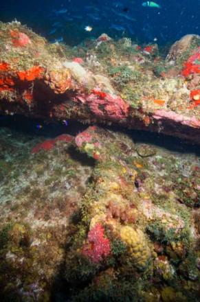
SE-510, otherwise known as Lost Anchors, is oriented southwest – northeast at a heading of 39 degrees and measures 900 meters long and between 3 and 10 meters wide. Its 350-meter-long central area consists of a high reef structure that protrudes between 3 and 4 meters from the 25-meter-deep sandy bottom surrounding it. The outcrop, covered by a dense reef, forms an impressive structure on an otherwise sandy sea floor, with large chunks of rocks about to slide off the top. It contains many cracks in which anchors could easily get stuck. Because of its dramatic topography, it attracts large quantities of fish and is overgrown by a variety of corals and sponges.
Status
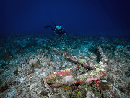
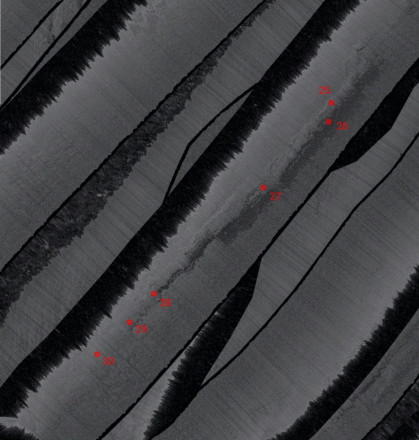
SE-510 is located in the central area of the historic roadstead of St. Eustatius. Here in the eighteenth-century, thousands of ships dropped anchor in order to trade at this free port. An investigation was carried out at the site in 2015 by the St. Eustatius Center for Archaeological Research in which three anchors and three anchor fragments were recorded. These anchors will further on be referenced by number (see bottom image). Six anchors were found to be associated with this reef: two intact anchors on top of the reef (numbers 25 and 28), one intact but heavily overgrown anchor immediately next to the reef (number 26), and three anchor pieces embedded in the reef (numbers 27, 29, and 30).
References
- Ruud Stelten (2019)
From Golden Rock to Historic Gem: A Historical Archaeological Analysis of the Maritime Cultural Landscape of St. Eustatius Dutch Caribbean
Leiden: Sidestone Press